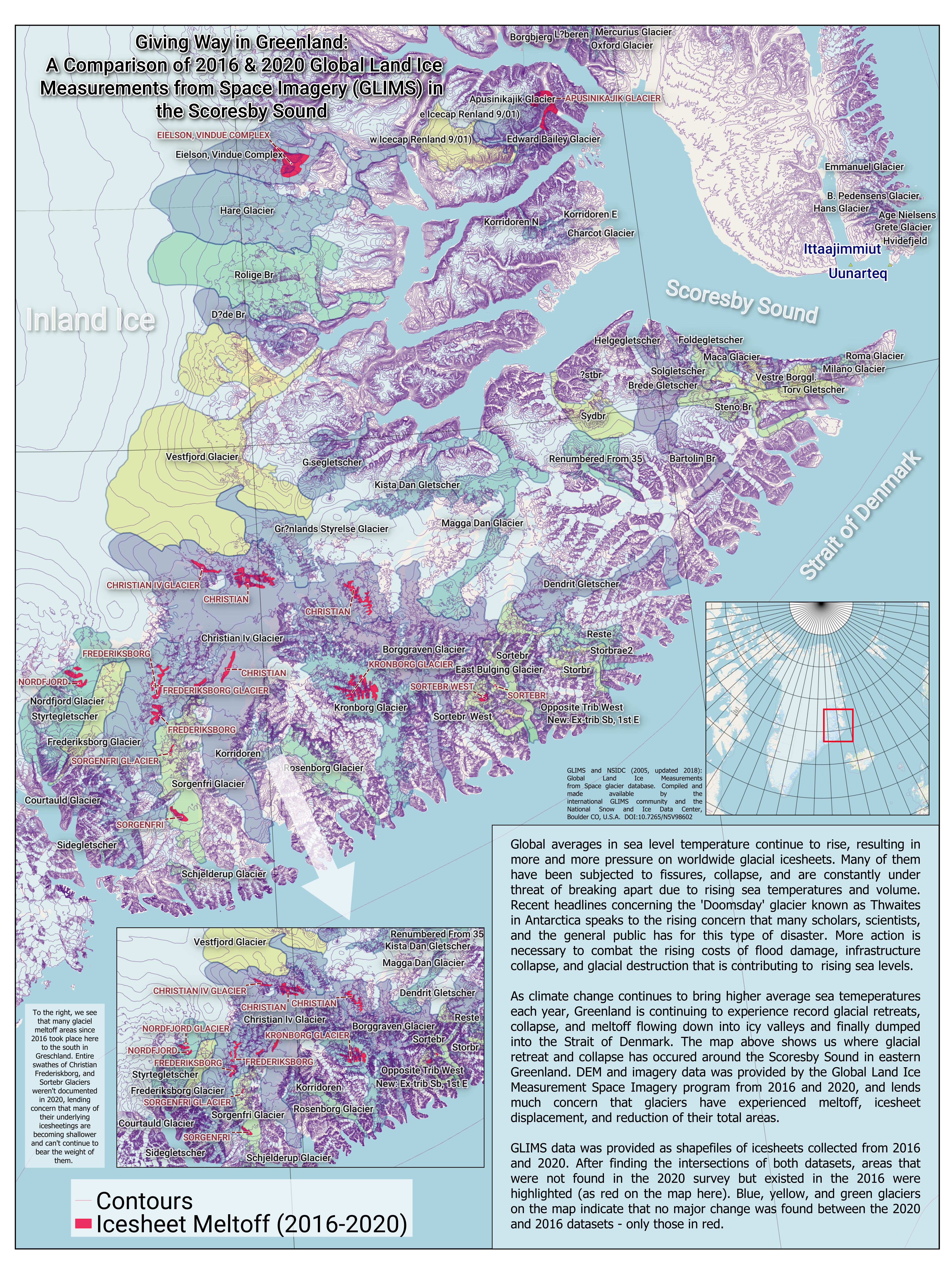
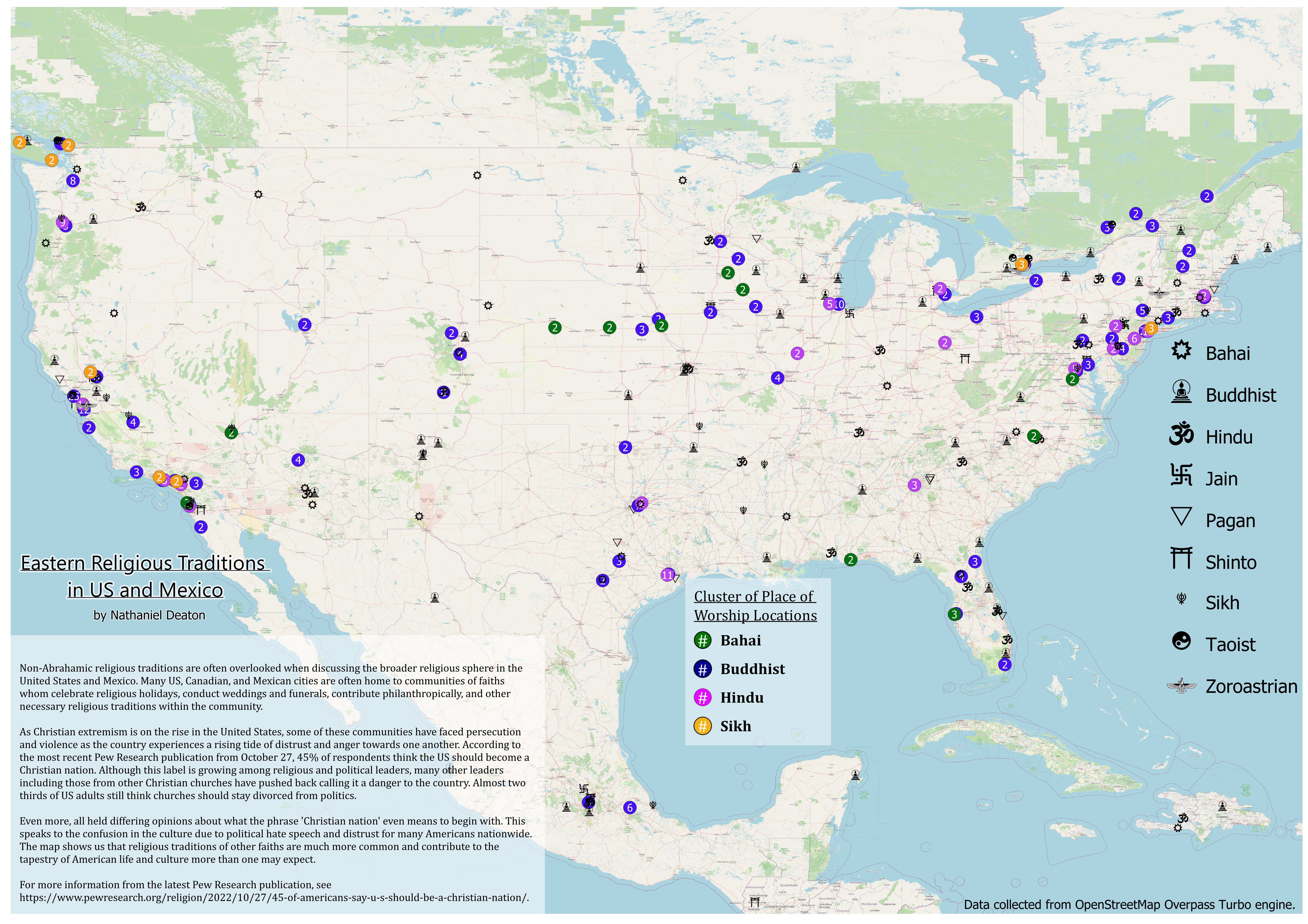
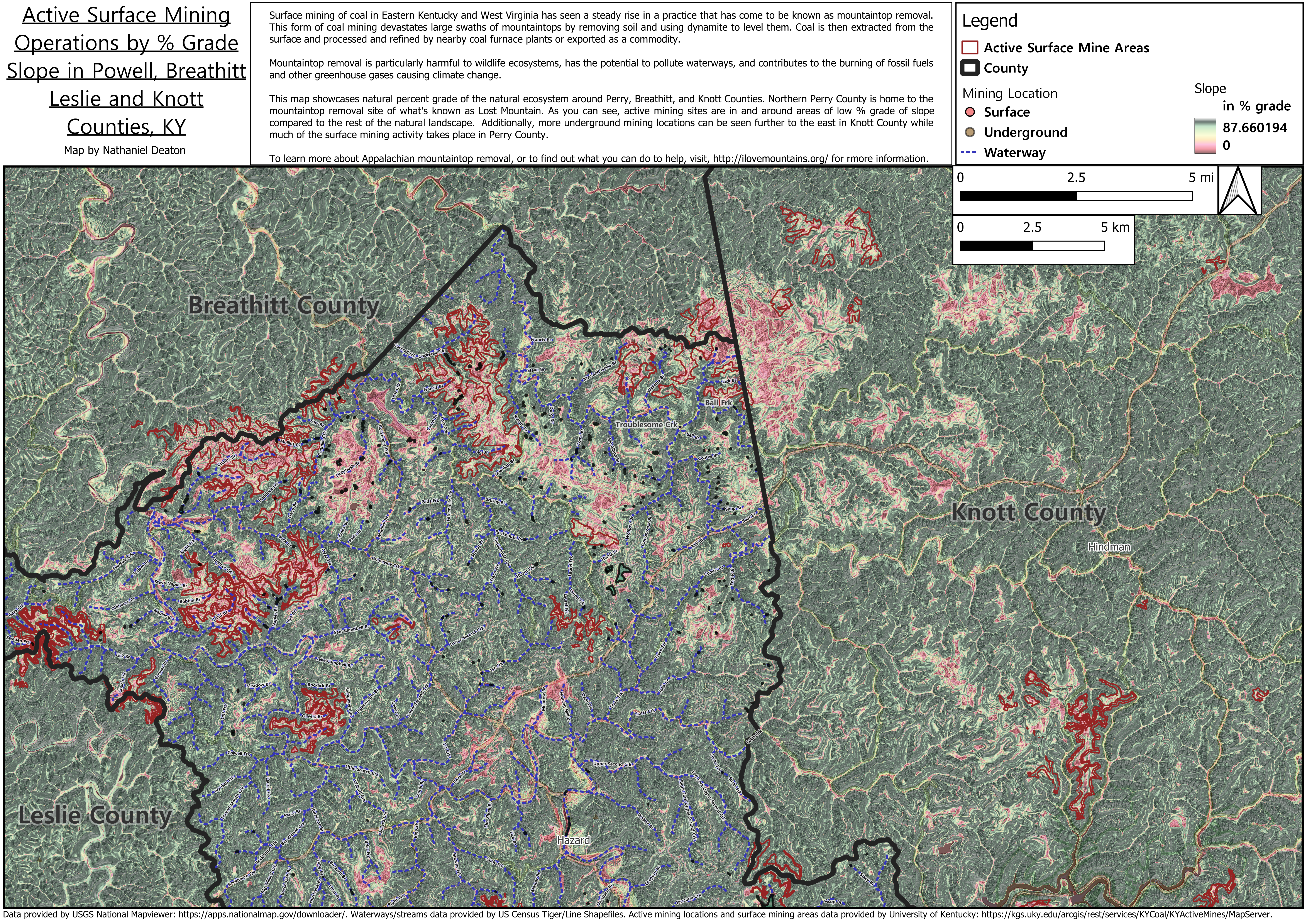
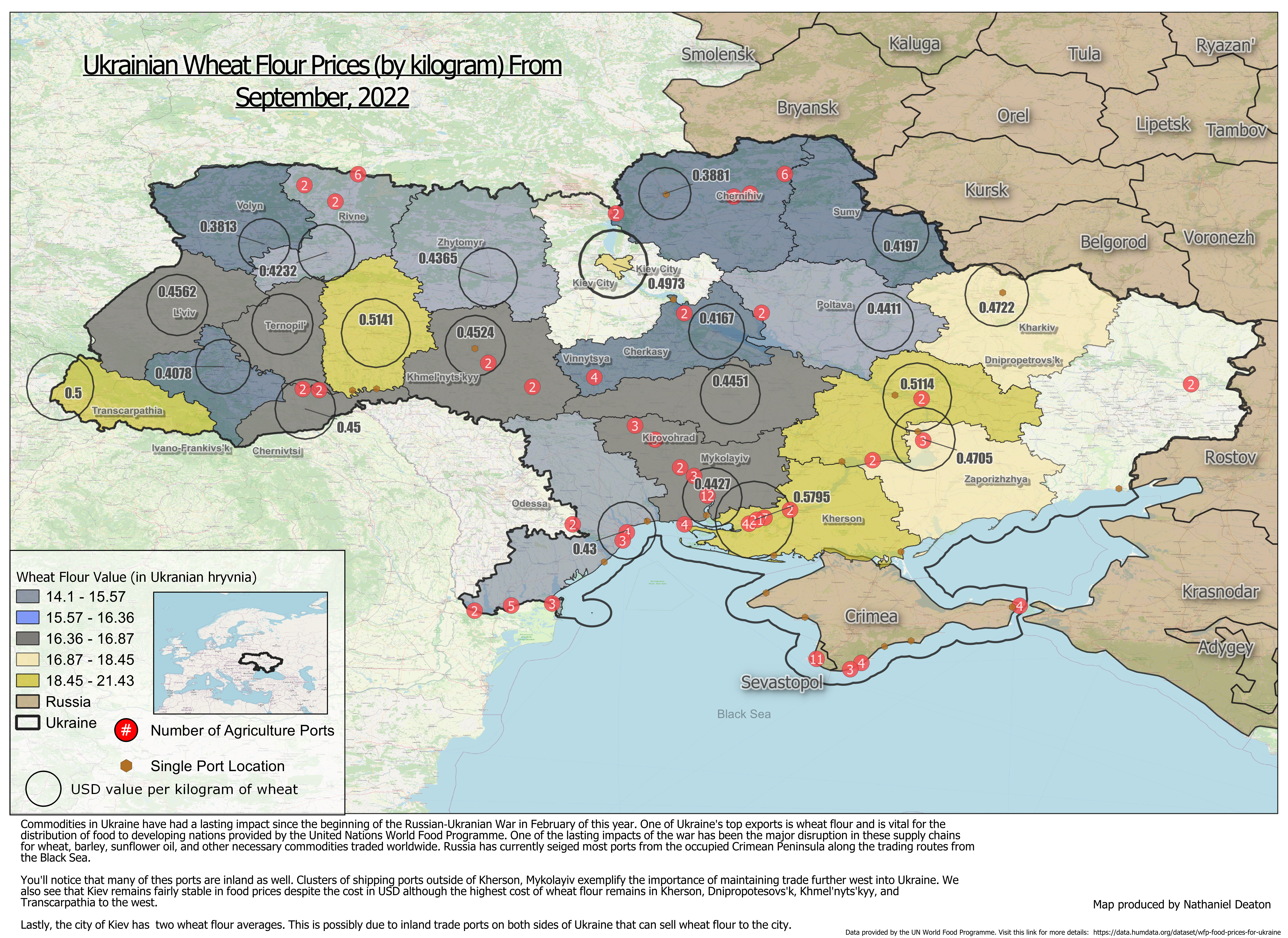
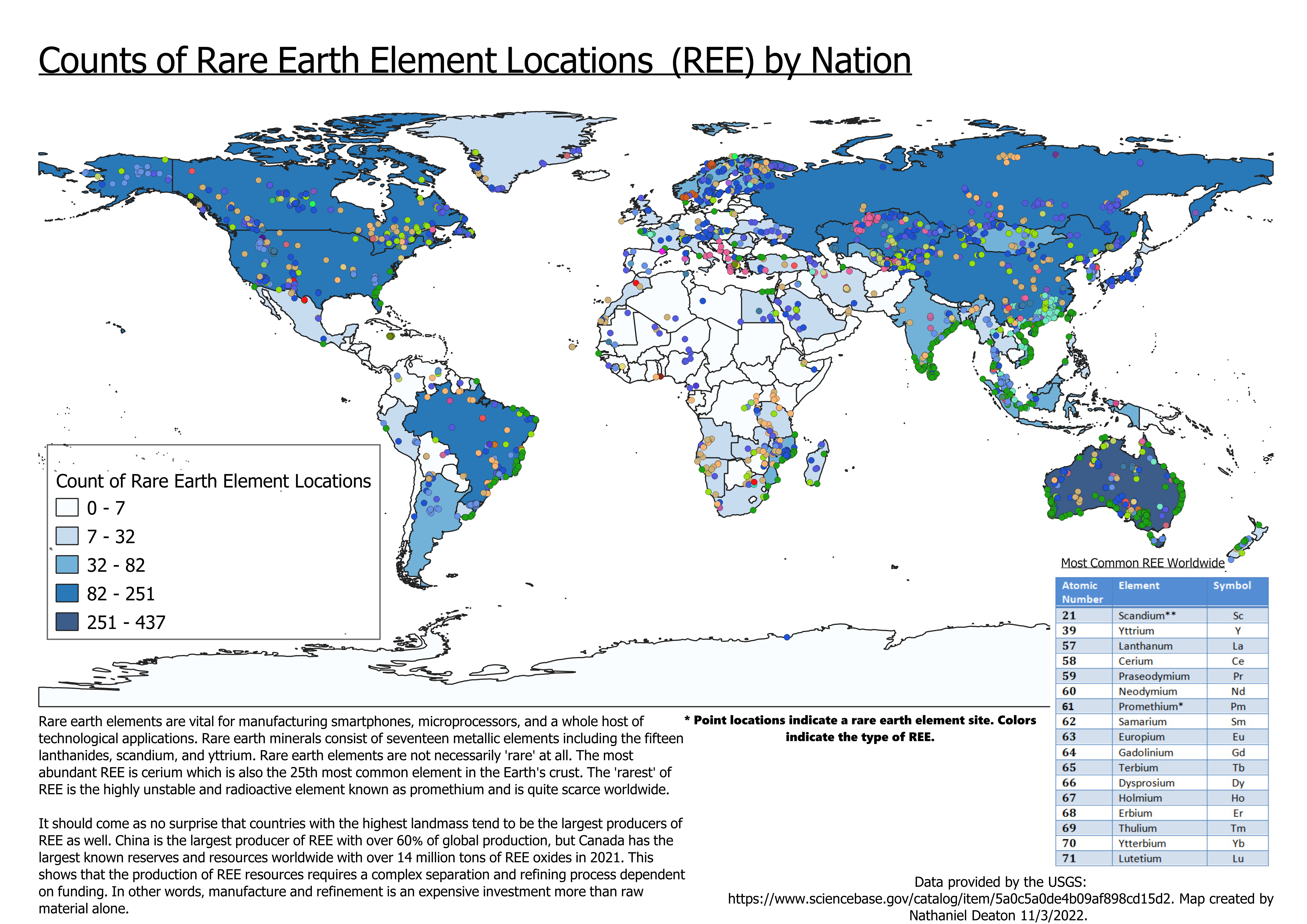
Data visuals, GIScience, happy little point clouds.
A collection of static maps produced in QGIS. Click on an image to view it in full size.